Caribbean tourism, fishing, farming bears brunt of climate change: CCCCC

Fishing and farming communities living in coastal areas as well the tourism industry, which is vital for Caribbean economies, often bear the brunt of damage and loss of income from “extreme precipitation”, which “translates into floods, landslides, loss of life, loss of livelihoods”.
Caribbean nations can now face as much rainfall in the space of a few days as they would normally get over a period of months, with drainage systems unable to cope, Trotz said.
“You don’t even need to have a hurricane to get extensive damage … a tropical storm or depression, it comes and sits over a particular island or territory and it deposits rain,” Trotz told the Thomson Reuters Foundation.
“For us small island nations, basically everything comes to a stop. As a region, we are very exposed to climate risk and our projections show that this will be exacerbated,” he said.
Trotz, whose organisation coordinates the entire region’s response to climate change, said: “We have some serious concerns about the viability of Caribbean life as we know it.”

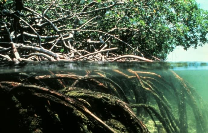
Mangroves are a natural defense system against storm surges and flooding. Their high biomass both above and below the water can help dissipate wave energy. Source: Public Domain.
Healthier ecosystems
One key way to make coastal areas more resilient to storm surges and rising sea levels, linked to global warming, is to protect marine, coral and mangrove ecosystems, Trotz said.
Reefs act like breakwaters reducing wave strength, while salt-tolerant mangroves can buffer against hurricane winds and storm surges and cut wave height.
“As far as the human body is concerned, the healthier the body is, the more resilient it will be in terms of dealing with some of the threats, diseases,” Trotz said.
“So the same principle applies here, that the healthier our ecosystems, the healthier our reefs, wetlands and mangroves are, the more they will be able to resist some of the impacts of climate change,” he said.
Across the Caribbean, scores of projects are underway to restore battered coral reefs, establish artificial reefs, replant damaged mangroves and place millions of acres of marine areas under protected areas by 2020.
Some Caribbean nations also face water shortages exacerbated by longer droughts linked to climate change, Trotz said.
In several islands of the Grenadines, a pilot seawater desalination project using solar power is underway.
In Guyana, to better cope with drought and changing rainy seasons, rice farmers are using water harvesting and drip irrigation systems, and are receiving short-term weather forecasts allowing them to better decide when to plant crops.

Red tape means many small island nations are unable to access funding from the Green Climate Fund, according to the article, which makes one wonder where the idea came from … Image snipped from the Green Climate Fund website. Is it a clue?
Faster money
But more defensive action is hampered by a lack of funds.
Despite the United Nations Green Climate Fund, set up in 2010 to help poor countries tackle climate change, red tape means many small island nations are unable to access funding.
“The bottom line is that we don’t have the resources,” Trotz said. “It’s not that we don’t have any idea about how we need to build resilience.”
It can take from nine months to up to eight years to get funds from donors, Trotz said.
“The longer you delay, a lot of the assumptions you have made in the first instance are no longer valid … we have to find some way of shortening that whole process.”
Source: Thomson Reuters Foundation, the charitable arm of Thomson Reuters.
What is the CCCCC?
The Caribbean Community Climate Change Centre (CCCCC) coordinates the Caribbean region’s response to climate change. Officially opened in August 2005, the Centre is “the key node for information on climate change issues and on the region’s response to managing and adapting to climate change in the Caribbean”, according to its website.
The CCCCC is the “repository and clearing house for regional climate change information and data and provides climate change-related policy advice and guidelines to the Caribbean Community (CARICOM) Member States through the CARICOM Secretariat”.
“In this role, the Centre is recognised by the United Nations Framework Convention on Climate Change (UNFCCC), the United Nations Environment Programme (UNEP), and other international agencies as the focal point for climate change issues in the Caribbean.”
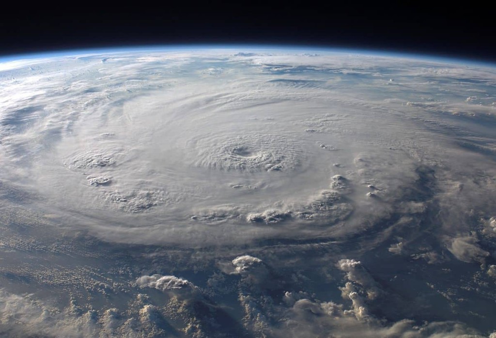
Featured image: By NASA. Hurricane Felix photographed from the International Space Station by an Expedition 15 crew member on September 3, 2007 at 11:38:46 GMT. The ISS was located at the nadir point of 16.9 degrees north latitude and 83.3 degrees west longitude, over the waters southwest of Grand Cayman Island. At approximately noon GMT, Hurricane Felix was near 14.2 degrees north latitude and 76.9 west longitude, about 260 miles (425 kilometers) south of Kingston, Jamaica, and 425 miles (685 kilometers) east of Cabo Gracias a Dios on the Nicaragua/Honduras border, moving west at 21 miles per hour (33 kilometers per hour). The sustained winds were 165 miles per hour with higher gusts making it a category 5 on the Saffir-Simpson Hurricane Scale.
Related posts


